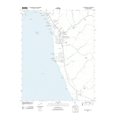
2012 Map of Half Moon Bay
USGS Topo · Published 2012About this map
The central San Mateo coast is defined by its series of distinct beaches and the small coastal settlements that follow the Cabrillo Hwy. In the early 21st century, Half Moon Bay remains the primary hub, with local landmarks like the Independent Order of Oddfellows Cem and the Pilarcitos Cem reflecting the area's deep community roots. North of town, the map shows the transition from the protected waters near the East Breakwater at Pillar Point to the long stretches of sand at Venice Beach and Miramar Beach.
Find a feature on this map
90 named features on this map. Tap any name to fly to it.
Don’t see what you’re looking for? This feature index may not catch every label — zoom into the map to look around manually.
Map Details
Editions of this 2012 Half Moon Bay Map
This is the sole edition of this map. No revisions or reprints were ever made.
Other maps of this area

1892 · San Mateo
USGS Topo · 1:62,500

1896 · San Mateo
USGS Topo · 1:62,500

1899 · San Mateo
USGS Topo · 1:62,500

1902 · Santa Cruz
USGS Topo · 1:125,000

1915 · San Mateo
USGS Topo · 1:62,500

1939 · San Mateo
USGS Topo · 1:62,500

1940 · Halfmoon Bay
USGS Topo · 1:62,500

1943 · San Mateo
USGS Topo · 1:62,500

1943 · Halfmoon Bay
USGS Topo · 1:62,500

1947 · San Francisco
USGS Topo · 1:250,000