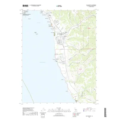
2018 Map of Half Moon Bay
USGS Topo · Published 2018About this map
Half Moon Bay serves as the focal point of this coastal landscape, where the urban grid meets the rising foothills of the Santa Cruz Mountains. The map documents a complex coastline of named beaches, from El Granada Beach and Miramar Beach down to Martins Beach, interspersed with rocky landmarks like Pillar Point and Seal Rock. Inland, the terrain is defined by deep cuts such as Pilarcitos Canyon and Higgins Canyon, with residential streets like Kelly St and Main St anchoring the town center. Genealogists and local historians will find value in the documentation of the Pilarcitos Cem and the Independent Order of Odd Fellows Cem, while the northern edge of the map is dominated by the Pillar Point AFS and the southern reaches of the Golden Gate National Recreation Area.
Find a feature on this map
98 named features on this map. Tap any name to fly to it.
Don’t see what you’re looking for? This feature index may not catch every label — zoom into the map to look around manually.
Map Details
Editions of this 2018 Half Moon Bay Map
This is the sole edition of this map. No revisions or reprints were ever made.
Other maps of this area

1892 · San Mateo
USGS Topo · 1:62,500

1896 · San Mateo
USGS Topo · 1:62,500

1899 · San Mateo
USGS Topo · 1:62,500

1902 · Santa Cruz
USGS Topo · 1:125,000

1915 · San Mateo
USGS Topo · 1:62,500

1939 · San Mateo
USGS Topo · 1:62,500

1940 · Halfmoon Bay
USGS Topo · 1:62,500

1943 · San Mateo
USGS Topo · 1:62,500

1943 · Halfmoon Bay
USGS Topo · 1:62,500

1947 · San Francisco
USGS Topo · 1:250,000