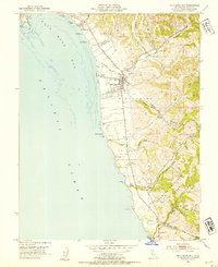
1952 Map of Half Moon Bay
USGS Topo · Published 1954About this map
Half Moon Bay serves as the central hub of this coastal survey, where the township is meticulously mapped with its High Sch, Cem, and various infrastructure including gasoline and water tanks. The landscape transitions from the sandy stretches of Naples Beach and Dunes Beach to the steep ravines of Arroyo Leon and Digges Canyon. Along the southern reaches of the coast, early petroleum exploration is evident via an Oil Prospect and Oil Derrick located near the shoreline.
Find a feature on this map
46 named features on this map. Tap any name to fly to it.
Don’t see what you’re looking for? This feature index may not catch every label — zoom into the map to look around manually.
Map Details
Editions of this 1952 Half Moon Bay Map
This is the sole edition of this map. No revisions or reprints were ever made.
Other maps of this area

1892 · San Mateo
USGS Topo · 1:62,500

1896 · San Mateo
USGS Topo · 1:62,500

1899 · San Mateo
USGS Topo · 1:62,500

1902 · Santa Cruz
USGS Topo · 1:125,000

1915 · San Mateo
USGS Topo · 1:62,500

1939 · San Mateo
USGS Topo · 1:62,500

1940 · Halfmoon Bay
USGS Topo · 1:62,500

1943 · San Mateo
USGS Topo · 1:62,500

1943 · Halfmoon Bay
USGS Topo · 1:62,500

1947 · San Francisco
USGS Topo · 1:250,000