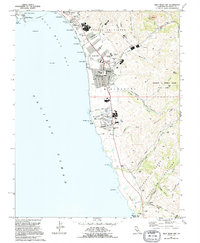
1991 Map of Half Moon Bay
USGS Topo · Published 1995About this map
Half Moon Bay and its rugged shoreline define this coastal survey, where the Santa Cruz Mountains meet the Pacific. The landscape is a transition between the established town center and the agricultural ranch lands to the south, marked by the expansive Burleigh H Murray Ranch State Park. Waterways like Pilarcitos Creek and Arroyo Leon cut through deep canyons toward the sea, while the coast is dotted with named beaches such as Venice Beach and Francis Beach.
Find a feature on this map
79 named features on this map. Tap any name to fly to it.
Don’t see what you’re looking for? This feature index may not catch every label — zoom into the map to look around manually.
Map Details
Editions of this 1991 Half Moon Bay Map
This is the sole edition of this map. No revisions or reprints were ever made.
Other maps of this area

1892 · San Mateo
USGS Topo · 1:62,500

1896 · San Mateo
USGS Topo · 1:62,500

1899 · San Mateo
USGS Topo · 1:62,500

1902 · Santa Cruz
USGS Topo · 1:125,000

1915 · San Mateo
USGS Topo · 1:62,500

1939 · San Mateo
USGS Topo · 1:62,500

1940 · Halfmoon Bay
USGS Topo · 1:62,500

1943 · San Mateo
USGS Topo · 1:62,500

1943 · Halfmoon Bay
USGS Topo · 1:62,500

1947 · San Francisco
USGS Topo · 1:250,000