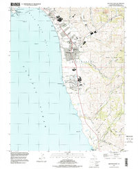
1997 Map of Half Moon Bay
USGS Topo · Published 1999About this map
The coastal shelf of San Mateo County meets the Pacific Ocean along a stretch of land defined by its long-standing ranching history and maritime presence. The central town of Half Moon Bay serves as the focal point, with its residential grid extending toward Francis Beach and Venice Beach. To the north, the Pillar Point Air Force Station stands near the sheltered waters of Pillar Point Harbor, while the rugged interior is carved by numerous drainages like Pilarcitos Creek and Frenchmans Creek.
Find a feature on this map
69 named features on this map. Tap any name to fly to it.
Don’t see what you’re looking for? This feature index may not catch every label — zoom into the map to look around manually.
Map Details
Editions of this 1997 Half Moon Bay Map
This is the sole edition of this map. No revisions or reprints were ever made.
Other maps of this area

1892 · San Mateo
USGS Topo · 1:62,500

1896 · San Mateo
USGS Topo · 1:62,500

1899 · San Mateo
USGS Topo · 1:62,500

1902 · Santa Cruz
USGS Topo · 1:125,000

1915 · San Mateo
USGS Topo · 1:62,500

1939 · San Mateo
USGS Topo · 1:62,500

1940 · Halfmoon Bay
USGS Topo · 1:62,500

1943 · San Mateo
USGS Topo · 1:62,500

1943 · Halfmoon Bay
USGS Topo · 1:62,500

1947 · San Francisco
USGS Topo · 1:250,000