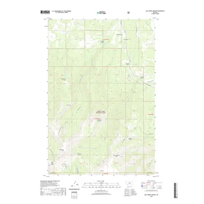
2020 Map of Half Moon Canyon
USGS Topo · Published 2020About this map
The Big Snowy Mountains dominate this central Montana landscape, where the high ridges of the Lewis & Clark National Forest meet the plains of Fergus and Golden Valley counties. This terrain is defined by dramatic vertical relief, reaching its height at Greathouse Peak and the prominent summit of Old Baldy. The map reveals a complex network of drainage systems, including the headwaters of the E Fork Big Spring Cr and Swimming Woman Cr, which have carved deep cuts like Stovepipe Canyon and North Horsethief Canyon into the limestone uplift. Access to this high country is marked by historic transit points such as Half Moon Pass and the rugged line of Knife Blade Ridge. On the lower slopes, the transition to ranching country is evident near Bowmans Bench and along Half Moon Ranch Rd.
Find a feature on this map
83 named features on this map. Tap any name to fly to it.
Don’t see what you’re looking for? This feature index may not catch every label — zoom into the map to look around manually.
Map Details
Editions of this 2020 Half Moon Canyon Map
This is the sole edition of this map. No revisions or reprints were ever made.
Other maps of this area

1889 · Big Snowy Mountain
USGS Topo · 1:250,000

1893 · Big Snowy Mountain
USGS Topo · 1:250,000

1954 · Roundup
USGS Topo · 1:250,000

1958 · Roundup
USGS Topo · 1:250,000
1970 · Alaska Bench
USGS Topo · 1:24,000
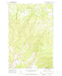
1970 · Half Moon Canyon
USGS Topo · 1:24,000
1970 · Heath
USGS Topo · 1:24,000
1970 · Castle Butte
USGS Topo · 1:24,000
1970 · Loco Ridge
USGS Topo · 1:24,000
1970 · Jump Off Peak
USGS Topo · 1:24,000