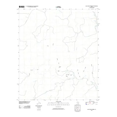
2010 Map of Half Moon Prairie
USGS Topo · Published 2010About this map
Half Moon Prairie defines this stretch of Edwards County, where the landscape is marked by a complex network of draws and bluffs. The elevation is anchored by landmarks such as Painted Bluff and Fern Bluff, which overlook the intermittent drainages of Wildcat Draw and Black Stump Draw. This terrain is characteristic of the Edwards Plateau, where water sources like Polecat Spring were historically critical for land use.
Find a feature on this map
21 named features on this map. Tap any name to fly to it.
Don’t see what you’re looking for? This feature index may not catch every label — zoom into the map to look around manually.
Map Details
Editions of this 2010 Half Moon Prairie Map
This is the sole edition of this map. No revisions or reprints were ever made.
Other maps of this area

1893 · Nueces
USGS Topo · 1:125,000

1896 · Nueces
USGS Topo · 1:125,000

1944 · Barksdale
USGS Topo · 1:62,500

1944 · Indian Creek
USGS Topo · 1:62,500

1944 · Indian Mountain
USGS Topo · 1:62,500

1947 · Hackberry
USGS Topo · 1:62,500

1958 · Del Rio
USGS Topo · 1:250,000

1964 · Del Rio
USGS Topo · 1:250,000
1967 · Indian Mountain
USGS Topo · 1:24,000
1971 · Cub Lake
USGS Topo · 1:24,000