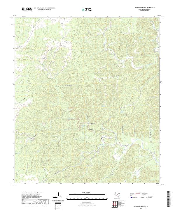
2022 Map of Half Moon Prairie
USGS Topo · Published 2022About this map
The tiny settlement of Half Moon Prairie sits at the heart of this Edwards County landscape, where the terrain is carved by an intricate network of limestone-character draws and springs. The local geography is defined by prominent landmarks like Painted Bluff and Fern Bluff, overlooking the seasonal waters of Spring Cr. Evidence of early ranching and rural life is preserved in the location of the Coalson Cem and the naming of various water sources such as Paint Bluff Springs, Roberts Springs, and Dripping Springs. A complex drainage pattern is visible through the winding paths of Wildcat Draw, Black Stump Draw, and Mitchell Hollow, reflecting the importance of water management in this part of Texas. Modern access is limited to a few thoroughfares, including Cedar Creek Rd and Co Rd 104, which navigate the high divides between the deeply etched Slide Canyon and the surrounding prairie.
Find a feature on this map
26 named features on this map. Tap any name to fly to it.
Don’t see what you’re looking for? This feature index may not catch every label — zoom into the map to look around manually.
Map Details
Editions of this 2022 Half Moon Prairie Map
This is the sole edition of this map. No revisions or reprints were ever made.
Other maps of this area

1893 · Nueces
USGS Topo · 1:125,000

1896 · Nueces
USGS Topo · 1:125,000

1944 · Barksdale
USGS Topo · 1:62,500

1944 · Indian Creek
USGS Topo · 1:62,500

1944 · Indian Mountain
USGS Topo · 1:62,500

1947 · Hackberry
USGS Topo · 1:62,500

1958 · Del Rio
USGS Topo · 1:250,000

1964 · Del Rio
USGS Topo · 1:250,000
1967 · Indian Mountain
USGS Topo · 1:24,000
1971 · Cub Lake
USGS Topo · 1:24,000