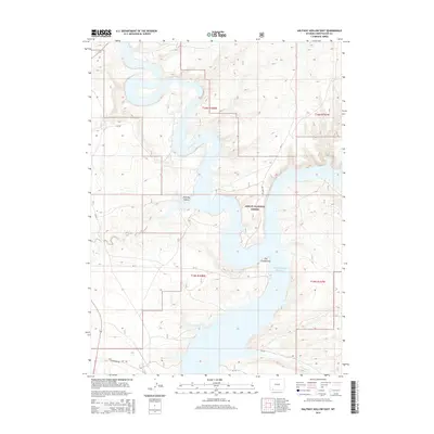
2015 Map of Halfway Hollow East
USGS Topo · Published 2015About this map
Ashley National Forest dominates the eastern half of this landscape, where the waters of the Blacks Fork wind south toward their meeting with the Green River. This junction, marked as The Confluence, is now part of the extensive Flaming Gorge Reservoir, which fills the canyon floor and creates an intricate, winding shoreline against the surrounding high desert. The western portion of the sheet is characterized by the wide, arid drainage of Halfway Hollow, a notable terrain feature that defines the local topography between the river system and the uplands.
Find a feature on this map
18 named features on this map. Tap any name to fly to it.
Don’t see what you’re looking for? This feature index may not catch every label — zoom into the map to look around manually.
Map Details
Editions of this 2015 Halfway Hollow East Map
This is the sole edition of this map. No revisions or reprints were ever made.
Other maps of this area

1954 · Rock Springs
USGS Topo · 1:250,000

1957 · Currant Creek Ranch
USGS Topo · 1:62,500

1957 · Mc Kinnon Junction
USGS Topo · 1:62,500

1957 · Firehole Basin
USGS Topo · 1:62,500

1958 · Rock Springs
USGS Topo · 1:250,000

1962 · Rock Springs
USGS Topo · 1:250,000

1966 · Firehole Basin
USGS Topo · 1:62,500

1966 · Mc Kinnon Junction
USGS Topo · 1:62,500

1966 · Buckboard Crossing
USGS Topo · 1:62,500

1966 · Currant Creek Ranch
USGS Topo · 1:62,500