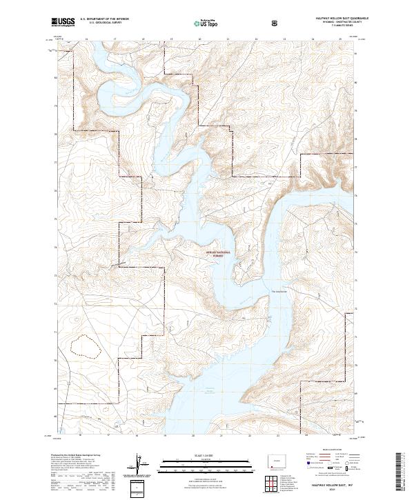
2021 Map of Halfway Hollow East
USGS Topo · Published 2021About this map
Flaming Gorge Reservoir dominates the southern landscape of this Sweetwater County region, where the winding waters of Blacks Fork meet the reservoir at a point designated as The Confluence. The map illustrates the rugged canyon and high desert topography characteristic of the Ashley National Forest, showing how the water levels interact with the steep terrain of Halfway Hollow. Remote access is defined by a sparse network of unpaved routes like Lost Dog Rd and Buckboard Rd, which traverse the high plateaus and draws. In the far southeastern corner, the path of Currant Cr feeds toward the reservoir system, highlighting the complex drainage patterns of this arid environment. This survey provides a modern snapshot of the shoreline and public land boundaries during the early 21st century.
Find a feature on this map
12 named features on this map. Tap any name to fly to it.
Don’t see what you’re looking for? This feature index may not catch every label — zoom into the map to look around manually.
Map Details
Editions of this 2021 Halfway Hollow East Map
This is the sole edition of this map. No revisions or reprints were ever made.
Other maps of this area

1954 · Rock Springs
USGS Topo · 1:250,000

1957 · Currant Creek Ranch
USGS Topo · 1:62,500

1957 · Mc Kinnon Junction
USGS Topo · 1:62,500

1957 · Firehole Basin
USGS Topo · 1:62,500

1958 · Rock Springs
USGS Topo · 1:250,000

1962 · Rock Springs
USGS Topo · 1:250,000

1966 · Firehole Basin
USGS Topo · 1:62,500

1966 · Mc Kinnon Junction
USGS Topo · 1:62,500

1966 · Buckboard Crossing
USGS Topo · 1:62,500

1966 · Currant Creek Ranch
USGS Topo · 1:62,500