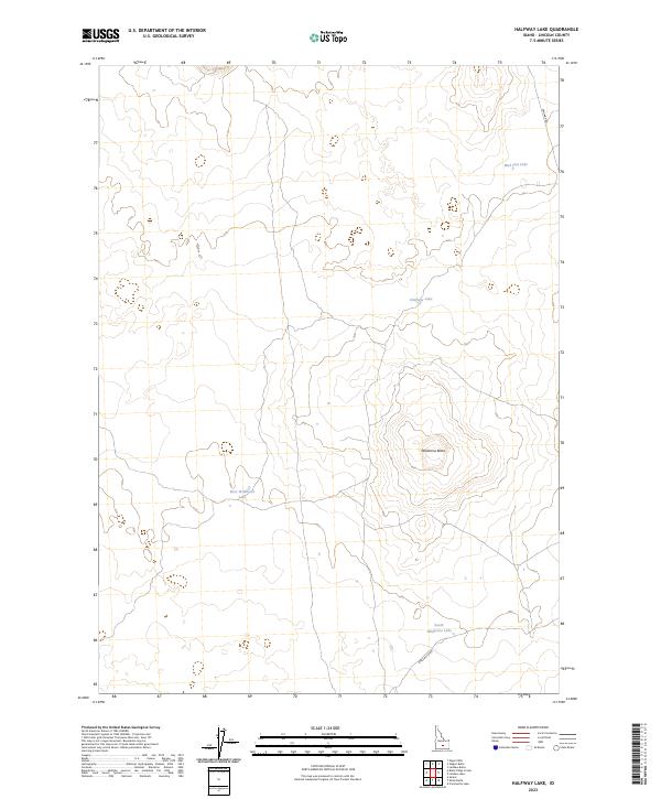
2023 Map of Halfway Lake
USGS Topo · Published 2023About this map
Wildhorse Butte dominates the central landscape of this Lincoln County quadrangle, rising above a series of ephemeral basins and volcanic terrain. This modern survey illustrates a high desert environment where water is the primary geographic anchor, as seen in the clustered depressions of Halfway Lake, West Wildhorse Lake, and South Wildhorse Lake. These features, along with Mud Flat Lake to the northeast, suggest a drainage pattern typical of Idaho's lava plateaus, where seasonal moisture collects in shallow, naming-worthy flats. Access to this quiet interior is limited to thoroughfares like Kamimah Rd and Shale Butte Rd, which trace the section lines and natural contours of the Snake River Plain. The map serves as a clear record of the region's topography, highlighting the isolation and subtle elevation changes of the high-altitude Idaho desert.
Find a feature on this map
7 named features on this map. Tap any name to fly to it.
Don’t see what you’re looking for? This feature index may not catch every label — zoom into the map to look around manually.
Map Details
Editions of this 2023 Halfway Lake Map
This is the sole edition of this map. No revisions or reprints were ever made.
Other maps of this area

1954 · Pocatello
USGS Topo · 1:250,000

1955 · Idaho Falls
USGS Topo · 1:250,000

1958 · Idaho Falls
USGS Topo · 1:250,000

1958 · Pocatello
USGS Topo · 1:250,000

1972 · Shale Butte
USGS Topo · 1:24,000

1972 · Community Lake
USGS Topo · 1:24,000

1972 · Laidlaw Lake
USGS Topo · 1:24,000
1972 · Senter
USGS Topo · 1:24,000

1972 · Laidlaw Butte
USGS Topo · 1:24,000

1978 · Craters Of The Moon
USGS Topo · 1:100,000