1979 Map of Halfway Lake
USGS Topo · Published 1979About this map
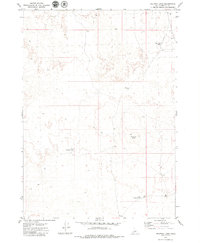
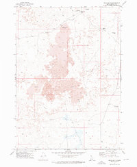
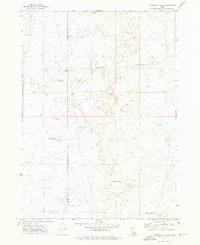
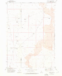
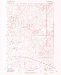
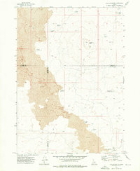
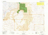
Halfway Lake and its surrounding high desert plains dominate this Idaho interior landscape, captured during the 1970s. The terrain is defined by a series of shallow basins and ephemeral water bodies, including West Wildhorse Lake, South Wildhorse Lake, and Mud Flat Lake, which reflect the region's unique drainage patterns where water often pools without an outlet to a major river system. Rising above the flat expanse, Wildhorse Butte provides a distinct vertical landmark used by surveyors and travelers alike. Remote and sparsely developed, the area is interlaced with several Jeep Trails and unnamed Trails, suggesting a land utilized for seasonal grazing and outdoor exploration rather than permanent settlement. The survey reflects the methodical mapping of the Usgs in an era when photogrammetric methods from 1971 aerial photography were refining our understanding of the Snake River Plain's high-altitude desert topography.
Find a feature on this map
11 named features on this map. Tap any name to fly to it.
Don’t see what you’re looking for? This feature index may not catch every label — zoom into the map to look around manually.
Map Details
Editions of this 1979 Halfway Lake Map
This is the sole edition of this map. No revisions or reprints were ever made.
Other maps of this area

1954 · Pocatello
USGS Topo · 1:250,000

1955 · Idaho Falls
USGS Topo · 1:250,000

1958 · Idaho Falls
USGS Topo · 1:250,000

1958 · Pocatello
USGS Topo · 1:250,000
1972 · Shale Butte
USGS Topo · 1:24,000
1972 · Community Lake
USGS Topo · 1:24,000
1972 · Laidlaw Lake
USGS Topo · 1:24,000
1972 · Senter
USGS Topo · 1:24,000
1972 · Laidlaw Butte
USGS Topo · 1:24,000
1978 · Craters Of The Moon
USGS Topo · 1:100,000