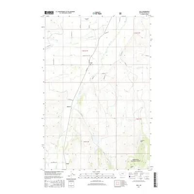
2017 Map of Hall
USGS Topo · Published 2017About this map
Hall serves as the central hub of this Granite County landscape, situated at the intersection of Main St and N Broadway. The settlement pattern follows the valley of Flint Creek, which runs north-south through the center of the sheet, providing a corridor for both transit and agriculture. To the south, the smaller communities of Sherryl and Stone appear along the drainage, while the eastern and southern edges are defined by the rising terrain of Limestone Ridge and the Deerlodge National Forest. This 2017 survey reveals an intricate network of rural infrastructure, from the Allendale Ditch and Lower Willow Cr in the north to the family-named ranch roads like Jensen Ranch Ln and Hendrix Ranch Ln. The presence of the Drummond Airport near the northern boundary and the rugged heights of Douglas Mtn illustrate the diverse uses of this mountain valley, where aviation and ranching meet the edge of protected wilderness.
Find a feature on this map
42 named features on this map. Tap any name to fly to it.
Don’t see what you’re looking for? This feature index may not catch every label — zoom into the map to look around manually.
Map Details
Editions of this 2017 Hall Map
This is the sole edition of this map. No revisions or reprints were ever made.
Other maps of this area

1908 · Philipsburg
USGS Topo · 1:125,000

1919 · Drummond
USGS Topo · 1:125,000

1921 · Drummond
USGS Topo · 1:125,000

1947 · Butte
USGS Topo · 1:250,000

1958 · Butte
USGS Topo · 1:250,000

1958 · Drummond
USGS Topo · 1:62,500

1959 · Bearmouth
USGS Topo · 1:62,500

1960 · Butte
USGS Topo · 1:250,000

1962 · Butte
USGS Topo · 1:250,000

1971 · Henderson Mountain
USGS Topo · 1:24,000