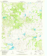
1979 Map of Hall
USGS Topo · Published 1980About this map
Hall sits at the center of this Texas landscape, where the Atchison Topeka and Santa Fe railroad corridor cuts through the valley. The map documents a rural environment defined by drainage systems like Richland Springs Creek and North Goens Creek, with a network of cattle-country fencing noted by fine dashed lines throughout the terrain. Prominent topographic landmarks include Round Mountain and the elevation gains around Clements Hollow.
Find a feature on this map
27 named features on this map. Tap any name to fly to it.
Don’t see what you’re looking for? This feature index may not catch every label — zoom into the map to look around manually.
Map Details
Editions of this 1979 Hall Map
This is the sole edition of this map. No revisions or reprints were ever made.
Other maps of this area

1885 · San Saba
USGS Topo · 1:125,000

1894 · Brady
USGS Topo · 1:125,000

1894 · San Saba
USGS Topo · 1:125,000

1925 · Brady 1-b
USGS Topo · 1:48,000

1925 · Brady 1-a
USGS Topo · 1:48,000

1925 · San Saba 2-b
USGS Topo · 1:48,000

1928 · Mercury
USGS Topo · 1:62,500

1930 · Richland Springs
USGS Topo · 1:62,500

1948 · Richland Springs
USGS Topo · 1:62,500

1950 · Mercury
USGS Topo · 1:62,500