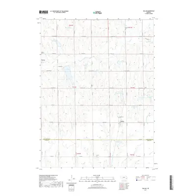
2017 Map of Hallam
USGS Topo · Published 2017About this map
Hallam and Kramer anchor this portion of the rural landscape along the border of Lancaster and Gage Counties. The terrain is defined by an extensive water management system, including Olive Creek Lake and numerous engineered basins such as Salt Creek Reservoir 25-A and Meadow Lake Number 1. This network of reservoirs and small tributaries like Olive Br and Spring Br illustrates the agricultural reliance on controlled water resources in the eastern Nebraska plains.
Find a feature on this map
60 named features on this map. Tap any name to fly to it.
Don’t see what you’re looking for? This feature index may not catch every label — zoom into the map to look around manually.
Map Details
Editions of this 2017 Hallam Map
This is the sole edition of this map. No revisions or reprints were ever made.
Other maps of this area

1897 · Lincoln
USGS Topo · 1:125,000

1955 · Lincoln
USGS Topo · 1:250,000

1957 · Lincoln
USGS Topo · 1:250,000

1957 · Clatonia
USGS Topo · 1:24,000

1957 · Wilber
USGS Topo · 1:24,000

1958 · Lincoln
USGS Topo · 1:250,000

1964 · Cortland
USGS Topo · 1:24,000

1964 · Pickrell
USGS Topo · 1:24,000
1964 · Hallam
USGS Topo · 1:24,000
1964 · Crete South
USGS Topo · 1:24,000