
2012 Map of Halls
USGS Topo · Published 2012About this map
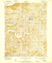
Saint Joseph sits at the eastern edge of this landscape, where the Missouri River creates a dynamic border between Missouri and Kansas. The oxbow legacy of the river is clearly visible in the presence of Old Mud Lake, New Mud Lake, and Horseshoe Lake, remnants of the water's shifting course through the floodplain. Small rural settlements like Palermo and Halls anchor the agricultural grid, while Lake Station and Kirschner mark the western outskirts of the city. Transportation routes follow the natural topography, with SW Bluff Rd skirting the elevations near Contrary Creek. The map documents a blend of industrial and rural land use, highlighted by the Farmland Industries Incorporated Lake and the quiet presence of Bethel Cemetery near Halls Lake, reflecting the long-term community footprint in this river valley.
Find a feature on this map
64 named features on this map. Tap any name to fly to it.
Don’t see what you’re looking for? This feature index may not catch every label — zoom into the map to look around manually.
Map Details
Editions of this 2012 Halls Map
This is the sole edition of this map. No revisions or reprints were ever made.
Other maps of this area

1885 · Atchison
USGS Topo · 1:125,000

1888 · Atchison
USGS Topo · 1:125,000

1893 · Atchison
USGS Topo · 1:125,000

1924 · St. Joseph
USGS Topo · 1:62,500

1926 · Atchison
USGS Topo · 1:62,500

1926 · Saint Joseph
USGS Topo · 1:62,500

1926 · Oregon
USGS Topo · 1:62,500

1927 · Dearborn
USGS Topo · 1:62,500

1950 · Kansas City
USGS Topo · 1:250,000
1951 · De Kalb
USGS Topo · 1:24,000