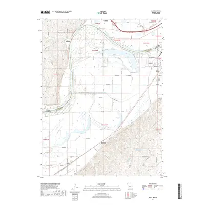
2017 Map of Halls
USGS Topo · Published 2017About this map
The Missouri River carves a complex boundary between Kansas and Missouri, creating a landscape defined by its floodplains and former river channels. In this environment, several oxbow lakes and wetlands persist, including Horseshoe Lake, Old Mud Lake, and New Mud Lake, which mark the historical path of the river. The small community of Halls sits at the base of the bluff line, connected by Co Rte 233 to Kenmoor. On the eastern edge, the industrial and residential outskirts of Saint Joseph appear near the prominent Lake Contrary.
Find a feature on this map
89 named features on this map. Tap any name to fly to it.
Don’t see what you’re looking for? This feature index may not catch every label — zoom into the map to look around manually.
Map Details
Editions of this 2017 Halls Map
This is the sole edition of this map. No revisions or reprints were ever made.
Other maps of this area

1885 · Atchison
USGS Topo · 1:125,000

1888 · Atchison
USGS Topo · 1:125,000

1893 · Atchison
USGS Topo · 1:125,000

1924 · St. Joseph
USGS Topo · 1:62,500

1926 · Atchison
USGS Topo · 1:62,500

1926 · Saint Joseph
USGS Topo · 1:62,500

1926 · Oregon
USGS Topo · 1:62,500

1927 · Dearborn
USGS Topo · 1:62,500

1950 · Kansas City
USGS Topo · 1:250,000
1951 · De Kalb
USGS Topo · 1:24,000