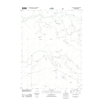
2012 Map of Halls Canyon
USGS Topo · Published 2012About this map
The Pit River winds through the northern reaches of this Modoc County terrain, carving a path past Ostrom Point and Allen Butte. This landscape is defined by its numerous water sources, including the isolated Twin Lakes and a network of named springs like Eades Spring and Quaking Aspen Spring that support the surrounding high country. The topography transitions from the dramatic elevations of Iron Mountain and Black Butte down to the level grounds of Miller Flat and Dutch Flat. Local transportation is marked by rural routes such as Co RD 85 and E Gouger Neck RD, which provide access to the drainages of Halls Canyon and Howell Canyon. This 2012 survey captures the essential hydrologic and geologic character of the region, from the seasonal flows of Stone Coal Cr to the prominent heights of Fox Mountain.
Find a feature on this map
39 named features on this map. Tap any name to fly to it.
Don’t see what you’re looking for? This feature index may not catch every label — zoom into the map to look around manually.
Map Details
Editions of this 2012 Halls Canyon Map
This is the sole edition of this map. No revisions or reprints were ever made.
Other maps of this area

1886 · Alturas
USGS Topo · 1:250,000

1886 · Modoc Lava Bed
USGS Topo · 1:250,000

1892 · Modoc Lava-Bed
USGS Topo · 1:250,000

1892 · Alturas
USGS Topo · 1:250,000

1954 · Alturas
USGS Topo · 1:250,000

1958 · Alturas
USGS Topo · 1:250,000

1961 · Canby
USGS Topo · 1:62,500

1961 · Bieber
USGS Topo · 1:62,500

1962 · Alturas
USGS Topo · 1:250,000

1962 · Crank Mountain
USGS Topo · 1:62,500