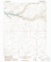
1987 Map of Halls Crossing NE
USGS Topo · Published 1987About this map
Emigrant Trail tracks across this high desert landscape, offering a window into the historic movement of people through the difficult terrain of San Juan County. This 1980s-era survey documents the intersection of deep canyon geology and modern water management following the creation of Lake Powell, which fills the lower reaches of Glen Canyon. The map records the complex drainage systems of Moqui Canyon and North Gulch before they reach the reservoir's edge. This provisional mapping illustrates how human activity is limited primarily to the Glen Canyon National Recreation Area and specialized sites like a remote Gravel Pit. The presence of Lake Canyon in the southwest provides additional detail on the winding tributaries that define this portion of the Colorado River plateau.
Find a feature on this map
11 named features on this map. Tap any name to fly to it.
Don’t see what you’re looking for? This feature index may not catch every label — zoom into the map to look around manually.
Map Details
Editions of this 1987 Halls Crossing NE Map
2 editions found
Other maps of this area

1886 · Henry Mountains
USGS Topo · 1:250,000

1892 · Henry Mountains
USGS Topo · 1:250,000

1952 · Mancos Mesa
USGS Topo · 1:62,500

1953 · Lake Canyon
USGS Topo · 1:62,500

1953 · Mt. Ellsworth
USGS Topo · 1:62,500

1954 · White Canyon 3 SW
USGS Topo · 1:24,000

1954 · Clay Hills 2 SW
USGS Topo · 1:24,000

1954 · Clay Hills 2 NW
USGS Topo · 1:24,000
1954 · Clay Hills
USGS Topo · 1:62,500

1956 · Escalante
USGS Topo · 1:250,000