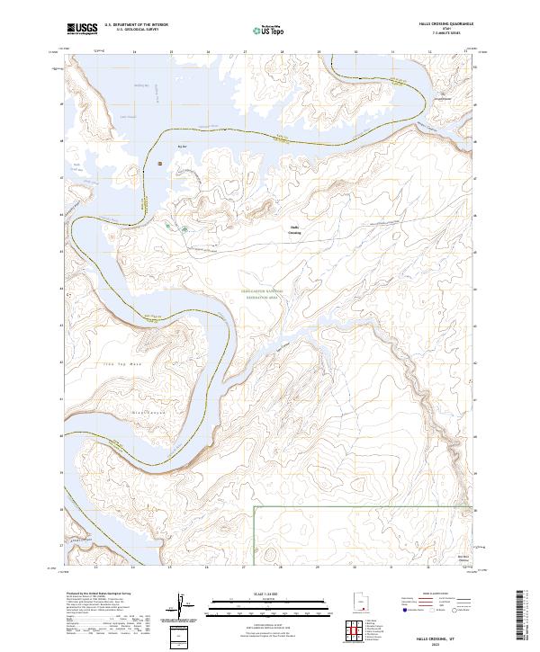
2023 Map of Halls Crossing
USGS Topo · Published 2023About this map
Halls Crossing serves as a critical junction for travelers navigating the extensive waters of Lake Powell within the Glen Canyon National Recreation Area. This modern survey details the infrastructure required for access to the lake, specifically the Halls Crossing Access Road and the Halls Crossing Marina Road which lead down to the submerged canyon floor. The landscape is defined by the sharp contrast between the deep waters of Bullfrog Bay and the surrounding high terrain of Iron Top Mesa and the Red Rock Plateau. Notable geological features like The Amphitheater and Moqui Canyon demonstrate how the modern reservoir interacts with the ancient Colorado River corridor, flooding side canyons such as Lake Canyon while leaving prominent landmarks like Big Bar above the waterline.
Find a feature on this map
21 named features on this map. Tap any name to fly to it.
Don’t see what you’re looking for? This feature index may not catch every label — zoom into the map to look around manually.
Map Details
Editions of this 2023 Halls Crossing Map
This is the sole edition of this map. No revisions or reprints were ever made.
Other maps of this area

1886 · Henry Mountains
USGS Topo · 1:250,000

1892 · Henry Mountains
USGS Topo · 1:250,000

1953 · The Rincon
USGS Topo · 1:62,500

1953 · Lake Canyon
USGS Topo · 1:62,500

1953 · Mt. Ellsworth
USGS Topo · 1:62,500

1953 · Hall Mesa
USGS Topo · 1:62,500

1956 · Escalante
USGS Topo · 1:250,000

1960 · Escalante
USGS Topo · 1:250,000
1980 · Hite Crossing
USGS Topo · 1:100,000
1981 · Navajo Mountain
USGS Topo · 1:100,000