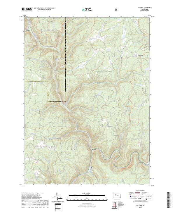
2023 Map of Hallton
USGS Topo · Published 2023About this map
The Clarion Wild and Scenic River carves a deep, winding path through this portion of the Allegheny National Forest, where the topography is defined by narrow creek valleys and timbered ridges. Along the river banks, the small settlement of Hallton and the nearby Arroyo represent historic riverside activity, with the Maxwell Run Cem serving as a local genealogical landmark. This area, straddling the Elk and Forest county lines, is heavily marked by a complex network of forest roads and trails, including the Scht - Parrish Trl and various segments of the Allegheny Snowmobile Loop. Further north, isolated outposts like Parrish and Owls Nest sit among a landscape drained by numerous tributaries such as Spring Creek and East Branch Millstone Creek. The presence of established forest infrastructure like Hallton-Belltown Rd and Factory Rd highlights the long-standing importance of resource management and recreation in the Pennsylvania woods.
Find a feature on this map
69 named features on this map. Tap any name to fly to it.
Don’t see what you’re looking for? This feature index may not catch every label — zoom into the map to look around manually.
Map Details
Editions of this 2023 Hallton Map
This is the sole edition of this map. No revisions or reprints were ever made.
Other maps of this area

1918 · Loleta
USGS Topo · 1:62,500

1934 · Kane
USGS Topo · 1:48,000

1935 · Sheffield
USGS Topo · 1:48,000

1936 · Marienville
USGS Topo · 1:48,000

1939 · Kane
USGS Topo · 1:62,500

1940 · Hallton
USGS Topo · 1:48,000

1941 · Sheffield
USGS Topo · 1:62,500

1941 · Marienville
USGS Topo · 1:62,500

1943 · Hallton
USGS Topo · 1:62,500

1957 · Warren
USGS Topo · 1:250,000
Featured Places
- Millstone Township, PA
- Heath Township, PA
- Spring Creek Township, PA
- Hallton, Spring Creek Township
- Arroyo, Spring Creek Township