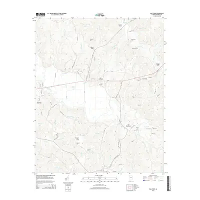
2014 Map of Halltown
USGS Topo · Published 2014About this map
Old Burleson and Halltown anchor this section of Franklin County, where the landscape is defined by the Tennessee Valley Divide and the headwaters of the Bear Creek system. The map reveals a dense network of family-associated cemeteries such as Weatherbee Cem, McCarley Cem, and Osborn Cem, providing essential markers for genealogical research in this rural pocket of Alabama. A distinct transport and water-power history is evident at Jordans Mill along Walker Br, while the curious name of Burntout and its adjacent Burntout Cem hint at the local lore and settlement history of the Freedom Hills region. Numerous creek branches, including Shoat Mill Br and Dentons Camp Br, carve through the hollows, illustrating the dissected topography that historically influenced movement and land use throughout the area.
Find a feature on this map
117 named features on this map. Tap any name to fly to it.
Don’t see what you’re looking for? This feature index may not catch every label — zoom into the map to look around manually.
Map Details
Editions of this 2014 Halltown Map
This is the sole edition of this map. No revisions or reprints were ever made.
Other maps of this area

1925 · Barton
USGS Topo · 1:62,500

1926 · Barton
USGS Topo · 1:48,000

1929 · Barton
USGS Topo · 1:62,500

1935 · Pleasant Site
USGS Topo · 1:24,000

1936 · Belmont
USGS Topo · 1:24,000

1936 · Pleasant Grove
USGS Topo · 1:24,000

1936 · Hodges
USGS Topo · 1:24,000

1936 · Red Bay
USGS Topo · 1:24,000

1936 · Vina
USGS Topo · 1:24,000

1936 · Halltown
USGS Topo · 1:24,000