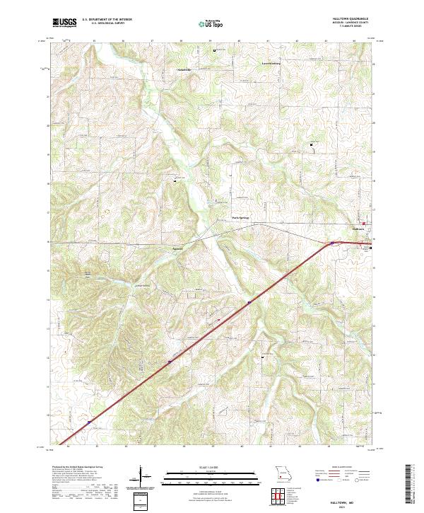
2021 Map of Halltown
USGS Topo · Published 2021About this map
Paris Springs and the village of Spencer sit at the heart of this Lawrence County landscape, where the legacy of early automotive travel is preserved along the alignment of Old Hwy 66. This corridor follows the drainage of Turnback Creek, which winds through the terrain alongside other local watercourses like Billies Cr and Johnson Cr. The settlement pattern is defined by small, dispersed communities including Nickelville, Lawrenceburg, and Halltown, each connected by a dense network of county roads. Genealogists will find several family and community burial grounds documented across the area, such as Rock Prairie Cem and Dunkle Cem. Unique geographical features like the Devils Wash Pan and Carmen Hollow add character to this transition between the Ozark plateaus and the western plains.
Find a feature on this map
59 named features on this map. Tap any name to fly to it.
Don’t see what you’re looking for? This feature index may not catch every label — zoom into the map to look around manually.
Map Details
Editions of this 2021 Halltown Map
This is the sole edition of this map. No revisions or reprints were ever made.
Other maps of this area

1886 · Greenfield
USGS Topo · 1:125,000

1888 · Greenfield
USGS Topo · 1:125,000

1919 · Halltown
USGS Topo · 1:62,500

1921 · Stotts City
USGS Topo · 1:62,500

1954 · Springfield
USGS Topo · 1:250,000

1956 · Ash Grove
USGS Topo · 1:24,000
1956 · South Greenfield
USGS Topo · 1:24,000
1956 · Everton
USGS Topo · 1:24,000

1958 · Springfield
USGS Topo · 1:250,000

1959 · Springfield
USGS Topo · 1:250,000