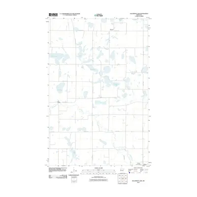
2010 Map of Halverson Lake
USGS Topo · Published 2010About this map
Little Norway Cemetery and the Faaberg Norwegian Lutheran Cemetery reflect the cultural heritage of this section of Polk County, where Norwegian settlement patterns shaped the local landscape. The small community of Rindal sits at the intersection of several local routes in the southeast corner, providing a focal point for the surrounding farmsteads. The terrain is defined by a dense concentration of glacial lakes and wetlands, including the prominent Halverson Lake, Cable Lake, and Lake Arthur. The Sand Hill River meanders across the southern half of the map, fed by smaller drainage features like Kittleson Creek and the Garden Slough. The road network is primarily composed of county highways, such as County Hwy-12 and County Hwy-34, which follow the section lines of the Public Land Survey System. This layout illustrates the persistent influence of nineteenth-century land division on modern Minnesota infrastructure.
Find a feature on this map
22 named features on this map. Tap any name to fly to it.
Don’t see what you’re looking for? This feature index may not catch every label — zoom into the map to look around manually.
Map Details
Editions of this 2010 Halverson Lake Map
This is the sole edition of this map. No revisions or reprints were ever made.
Other maps of this area

1918 · Twin Valley
USGS Topo · 1:62,500

1919 · Valley
USGS Topo · 1:62,500

1952 · Grand Forks
USGS Topo · 1:250,000

1956 · Grand Forks
USGS Topo · 1:250,000

1965 · Dugdale
USGS Topo · 1:24,000

1965 · Fertile
USGS Topo · 1:24,000

1965 · Flaming
USGS Topo · 1:24,000

1966 · Grand Forks
USGS Topo · 1:250,000
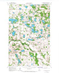
1966 · Halverson Lake
USGS Topo · 1:24,000

1966 · Union Lake
USGS Topo · 1:24,000