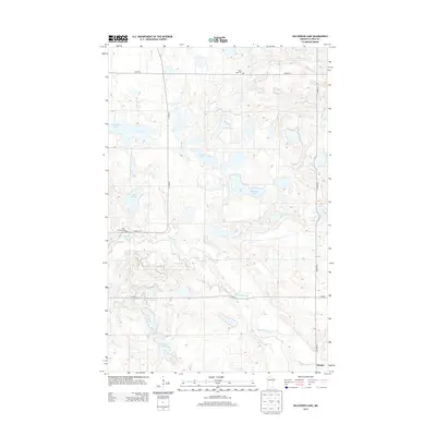
2013 Map of Halverson Lake
USGS Topo · Published 2013About this map
Glacial depressions and watercourses define this section of Polk County, where the meandering Sand Hill River and Garden Slough carve through the landscape south of Halverson Lake. This 2013 survey illustrates a rural environment characterized by a high density of small water bodies, including Cable Lake, Lake Arthur, and Kittleson Lake, many of which appear as terminal basins in the undulating topography. The small settlement of Rindal occupies the southeastern corner, serving as a focal point for the local agricultural community near the river. For those researching local heritage, the map identifies critical landmarks such as Little Norway Cem and Maple Lake Cem, which speak to the area's early Lutheran and Scandinavian immigrant history. The transportation network is built upon a grid of county highways, including Co HWY-12 and Co HWY-41, which navigate between the numerous sloughs and creek beds like Kittleson Cr.
Find a feature on this map
16 named features on this map. Tap any name to fly to it.
Don’t see what you’re looking for? This feature index may not catch every label — zoom into the map to look around manually.
Map Details
Editions of this 2013 Halverson Lake Map
This is the sole edition of this map. No revisions or reprints were ever made.
Other maps of this area

1918 · Twin Valley
USGS Topo · 1:62,500

1919 · Valley
USGS Topo · 1:62,500

1952 · Grand Forks
USGS Topo · 1:250,000

1956 · Grand Forks
USGS Topo · 1:250,000

1965 · Dugdale
USGS Topo · 1:24,000

1965 · Fertile
USGS Topo · 1:24,000

1965 · Flaming
USGS Topo · 1:24,000

1966 · Grand Forks
USGS Topo · 1:250,000
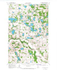
1966 · Halverson Lake
USGS Topo · 1:24,000

1966 · Union Lake
USGS Topo · 1:24,000