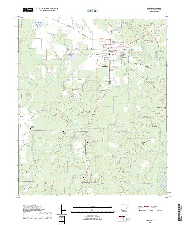
2024 Map of Hamburg
USGS Topo · Published 2024About this map
The Ashley County Courthouse serves as the civic center for Hamburg, Arkansas, where a dense grid of residential and commercial streets meets the agricultural and timbered landscapes of South Arkansas. The town's layout is defined by major thoroughfares like W Washington St and E Jefferson St, while religious and community heritage is preserved at the First United Methodist Church and the nearby Columbarium. The surrounding countryside is marked by numerous family and community burial grounds, including Evergreen Cem, Carter Cem, and Antioch Cem, which offer significant value for genealogical research in Ashley County.
Find a feature on this map
85 named features on this map. Tap any name to fly to it.
Don’t see what you’re looking for? This feature index may not catch every label — zoom into the map to look around manually.
Map Details
Editions of this 2024 Hamburg Map
This is the sole edition of this map. No revisions or reprints were ever made.
Other maps of this area

1935 · Mist
USGS Topo · 1:62,500

1935 · Wilmot
USGS Topo · 1:62,500

1952 · Fountain Hill
USGS Topo · 1:24,000

1953 · Greenwood
USGS Topo · 1:250,000

1956 · Greenwood
USGS Topo · 1:250,000

1960 · Mist
USGS Topo · 1:62,500

1960 · Wilmot
USGS Topo · 1:62,500

1960 · Wilmot NW
USGS Topo · 1:24,000
1960 · Mist
USGS Topo · 1:24,000
1960 · Wilmot SW
USGS Topo · 1:24,000