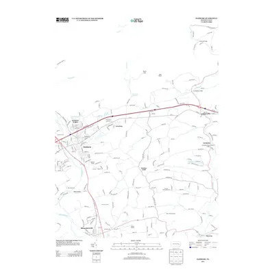
2013 Map of Hamburg
USGS Topo · Published 2013About this map
Hamburg and its surrounding Berks County landscapes are defined by the winding course of the Schuylkill River and the rural transition into the Blue Mountain foothills. This region preserves significant engineering history through its crossings, including the Dreibelbis Station Covered Bridge and Zettlemoyers Bridge spanning Maiden Creek. The settlement pattern reflects a mix of traditional crossroads such as Windsor Castle and Lenhartsville, alongside industrial-era locations like Five Locks and Shoemakersville. To the north, the terrain rises sharply toward landmarks like Pulpit Rock and the boulder field at Blue Rocks, while the Hamburg Reservoir and Blue Mountain Lake provide significant water resources for the area. The map also traces local recreation and utility sites, from the Berne Speedway and Skyline Airstrip to several golf courses and the expansive Ontelaunee Lake at the southern edge.
Find a feature on this map
203 named features on this map. Tap any name to fly to it.
Don’t see what you’re looking for? This feature index may not catch every label — zoom into the map to look around manually.
Map Details
Editions of this 2013 Hamburg Map
This is the sole edition of this map. No revisions or reprints were ever made.
Other maps of this area

1889 · Pottsville
USGS Topo · 1:62,500

1891 · Pottsville
USGS Topo · 1:62,500

1894 · Reading
USGS Topo · 1:62,500

1902 · Wernersville
USGS Topo · 1:62,500

1909 · Hamburg
USGS Topo · 1:62,500

1911 · Hamburg
USGS Topo · 1:62,500

1913 · Reading
USGS Topo · 1:62,500

1915 · Reading
USGS Topo · 1:62,500

1943 · Wernersville
USGS Topo · 1:62,500

1944 · Reading
USGS Topo · 1:62,500