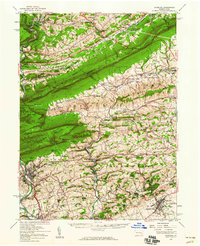
1956 Map of Hamburg
USGS Topo · Published 1960About this map
Blue Mountain serves as the dominant spine of this mid-century landscape, separating the agricultural valleys of Berks and Lehigh counties from the coal-region foothills to the north. The area is defined by its deep cultural roots and geological landmarks, from the Kutztown State Teachers College in the south to the world-renowned Hawk Mountain Sanctuary near Eckville. The 1950s terrain is dotted with small-scale industry and tourism, featuring subterranean attractions like Crystal Cave and Onyx Cave. Transportation follows the valley floors, with the Reading Railroad and Lehigh Valley Railroad paralleling the Schuylkill River and Lizard Creek. Local history is preserved in the numerous country schools and churches, including New Bethel Ch and the Old Order Ch, which anchor long-established rural communities such as New Tripoli and Lenhartsville.
Find a feature on this map
120 named features on this map. Tap any name to fly to it.
Don’t see what you’re looking for? This feature index may not catch every label — zoom into the map to look around manually.
Map Details
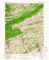
Editions of this 1956 Hamburg Map
2 editions found
Other maps of this area

1889 · Hazleton
USGS Topo · 1:62,500

1889 · Pottsville
USGS Topo · 1:62,500

1891 · Hazleton
USGS Topo · 1:62,500

1891 · Pottsville
USGS Topo · 1:62,500

1892 · Mahanoy
USGS Topo · 1:62,500

1893 · Hazleton
USGS Topo · 1:62,500

1893 · Mahanoy
USGS Topo · 1:62,500

1894 · Reading
USGS Topo · 1:62,500

1902 · Boyertown
USGS Topo · 1:62,500

1902 · Wernersville
USGS Topo · 1:62,500