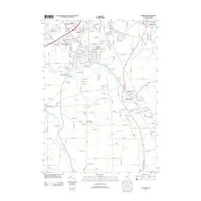
2013 Map of Hamburg
USGS Topo · Published 2013About this map
The Erie County Fairgrounds serves as a central landmark for this area of Erie County, situated just north of the village of Hamburg. The landscape is defined by the branching waters of Eighteenmile Cr and its tributaries, including Hampton Brook and Rush Cr, which carve through the terrain to form distinctive features like Big Gulf and Irish Gulf. Residential growth is evident in established communities such as Scranton, Armor, and North Boston, while the southern reaches of the map retain a strong agricultural character. Family-named operations and local camps, including Wittmeyer Dairy Farm, Mammoser Farms, and Toad Hollow Camp, highlight the rural heritage of the region. Genealogists may find value in the location of several burial grounds, such as Hillcrest Cem, Prospect Lawn Cem, and Mols Hill Cem, which sit alongside the local road networks and waterway valleys.
Find a feature on this map
150 named features on this map. Tap any name to fly to it.
Don’t see what you’re looking for? This feature index may not catch every label — zoom into the map to look around manually.
Map Details
Editions of this 2013 Hamburg Map
This is the sole edition of this map. No revisions or reprints were ever made.
Other maps of this area

1894 · Buffalo
USGS Topo · 1:62,500

1901 · Buffalo
USGS Topo · 1:62,500

1905 · Depew
USGS Topo · 1:62,500

1905 · Eden
USGS Topo · 1:62,500

1907 · Eden
USGS Topo · 1:62,500

1925 · Springville
USGS Topo · 1:62,500

1944 · Eden
USGS Topo · 1:62,500

1944 · North Collins
USGS Topo · 1:31,680

1944 · Hamburg
USGS Topo · 1:31,680

1944 · Langford
USGS Topo · 1:31,680