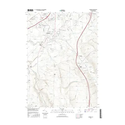
2016 Map of Hamburg
USGS Topo · Published 2016About this map
Eighteenmile Creek and its complex tributaries, including Hampton Brook and the South Branch Eighteenmile Creek, carve deep drainages through this part of Erie County. These natural features create distinctive terrain breaks such as Big Gulf, Irish Gulf, and Franklin Gulf, which contrast with the suburban development concentrated around Hamburg and Scranton. The map reveals a transition from the denser residential street grids of Carnegie and Forest Glen in the north to the more agrarian and valley-bottom settlements of Eden Valley and North Boston to the south. Local history is anchored by several burial grounds, including Hillcrest Cemetery near Armor and Mols Hill Cemetery in East Eden. The network of county roads, such as Gowanda State Road, highlights the transportation corridors that historically connected these outlying hamlets to the regional center.
Find a feature on this map
178 named features on this map. Tap any name to fly to it.
Don’t see what you’re looking for? This feature index may not catch every label — zoom into the map to look around manually.
Map Details
Editions of this 2016 Hamburg Map
This is the sole edition of this map. No revisions or reprints were ever made.
Other maps of this area

1894 · Buffalo
USGS Topo · 1:62,500

1901 · Buffalo
USGS Topo · 1:62,500

1905 · Depew
USGS Topo · 1:62,500

1905 · Eden
USGS Topo · 1:62,500

1907 · Eden
USGS Topo · 1:62,500

1925 · Springville
USGS Topo · 1:62,500

1944 · Eden
USGS Topo · 1:62,500

1944 · North Collins
USGS Topo · 1:31,680

1944 · Hamburg
USGS Topo · 1:31,680

1944 · Langford
USGS Topo · 1:31,680