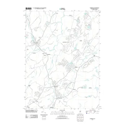
2011 Map of Hamburg
USGS Topo · Published 2011About this map
The Wallkill River and its many tributaries, including Papakating Creek and Beaver Run, define the drainage and settlement patterns of this corner of Sussex County. This landscape is characterized by its high concentration of local cemeteries, such as Union Cemetery, Deckertown Cemetery, and the Hardyston Cemetery, which serve as vital touchstones for family history in the townships. The map records a mix of established boroughs and smaller hamlets like Papakating, McAfee, and Rudeville, alongside recreational and conservation areas including Camp Glenwood and Lake Pochung. The presence of the Sussex Airport near Lewisburg and the rising elevations of the Hamburg Mountains to the east illustrate the varied use of the land between valley floors and upland ridges.
Find a feature on this map
64 named features on this map. Tap any name to fly to it.
Don’t see what you’re looking for? This feature index may not catch every label — zoom into the map to look around manually.
Map Details
Editions of this 2011 Hamburg Map
This is the sole edition of this map. No revisions or reprints were ever made.
Other maps of this area

1888 · Franklin
USGS Topo · 1:62,500

1891 · Greenwood Lake
USGS Topo · 1:62,500

1893 · Greenwood Lake
USGS Topo · 1:62,500

1894 · Franklin
USGS Topo · 1:62,500

1897 · Franklin
USGS Topo · 1:62,500

1903 · Franklin Furnace
USGS Topo · 1:62,500

1903 · Greenwood Lake
USGS Topo · 1:62,500

1906 · Port Jervis
USGS Topo · 1:62,500

1906 · Goshen
USGS Topo · 1:62,500

1908 · Goshen
USGS Topo · 1:62,500
Featured Places
- Vernon Township, NJ
- Wantage, NJ
- Wantage Township, Vernon Township
- Franklin, Hardyston Township
- Hamburg, Hardyston Township