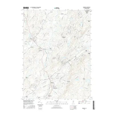
2016 Map of Hamburg
USGS Topo · Published 2016About this map
Hamburg and its neighboring boroughs of Sussex and Franklin anchor this detailed study of the Sussex County highlands in 2016. The landscape is defined by the sharp contrast between the valley floor, where the Wallkill River and Papakating Creek converge, and the rising elevations of Pochuck Mtn and the Hamburg Mountains. The area’s historical footprint is visible in the numerous burial grounds documented, including Union Cem, Deckertown Cem, and Fairview Cem.
Find a feature on this map
178 named features on this map. Tap any name to fly to it.
Don’t see what you’re looking for? This feature index may not catch every label — zoom into the map to look around manually.
Map Details
Editions of this 2016 Hamburg Map
This is the sole edition of this map. No revisions or reprints were ever made.
Other maps of this area

1888 · Franklin
USGS Topo · 1:62,500

1891 · Greenwood Lake
USGS Topo · 1:62,500

1893 · Greenwood Lake
USGS Topo · 1:62,500

1894 · Franklin
USGS Topo · 1:62,500

1897 · Franklin
USGS Topo · 1:62,500

1903 · Franklin Furnace
USGS Topo · 1:62,500

1903 · Greenwood Lake
USGS Topo · 1:62,500

1906 · Port Jervis
USGS Topo · 1:62,500

1906 · Goshen
USGS Topo · 1:62,500

1908 · Goshen
USGS Topo · 1:62,500
Featured Places
- Vernon Township, NJ
- Wantage, NJ
- Wantage Township, Vernon Township
- Franklin, Hardyston Township
- Hamburg, Hardyston Township