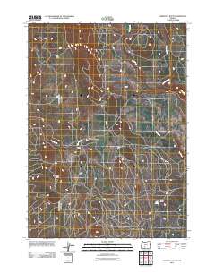
2011 Map of Hamelton Butte
USGS Topo · Published 2011About this map
Hamelton Butte rises as the central landmark in this high-elevation landscape within Klamath County, Oregon. The area is characterized by a network of seasonal and year-round water sources including Long Creek and Calahan Creek to the north, while Sand Creek and Dry Creek drain the southern slopes. Pockets of human activity are indicated by scattered outposts such as Petes Camp, Kings Cabin, and Sams Cabin, suggesting a history of seasonal residence, forestry, or hunting use. A central low point is marked by Stratton Meadow, providing a distinct break in the terrain. This 2011 survey records the road networks and water access points like Echo Spring, documenting the remote character of this Oregon wilderness as it was managed in the early 21st century.
Find a feature on this map
10 named features on this map. Tap any name to fly to it.
Don’t see what you’re looking for? This feature index may not catch every label — zoom into the map to look around manually.
Map Details
Editions of this 2011 Hamelton Butte Map
This is the sole edition of this map. No revisions or reprints were ever made.
Other maps of this area

1889 · Klamath
USGS Topo · 1:250,000

1894 · Klamath
USGS Topo · 1:250,000

1955 · Klamath Falls
USGS Topo · 1:250,000

1958 · Klamath Falls
USGS Topo · 1:250,000

1960 · Riverbed Butte
USGS Topo · 1:62,500

1960 · Sycan Marsh
USGS Topo · 1:62,500

1960 · Fuego Mountain
USGS Topo · 1:62,500

1960 · Yamsay Mountain
USGS Topo · 1:62,500

1980 · Williamson River
USGS Topo · 1:100,000
1988 · Sycan Marsh West
USGS Topo · 1:24,000