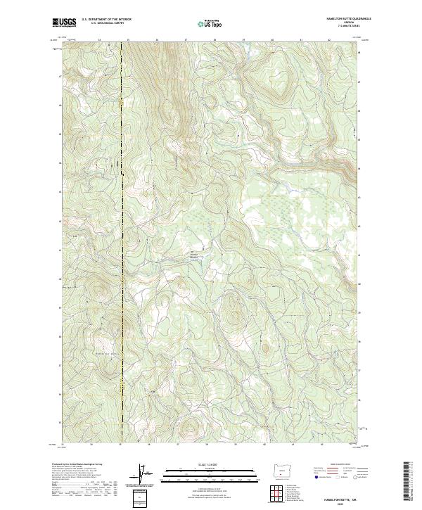
2023 Map of Hamelton Butte
USGS Topo · Published 2023About this map
Hamelton Butte serves as a prominent landmark in this high-altitude landscape along the border of Lake and Klamath counties. This 2023 survey illustrates a sparsely populated region defined by its complex hydrology and topographic ridges. To the north, Booth Ridge dictates the flow of local waterways, with Sand Creek and Long Creek carving through the terrain. The presence of Stratton Meadow suggests a seasonal catchment area amidst the timbered slopes, while isolated water sources like Echo Spring provide vital points of interest for those navigating the backcountry. The map also traces the headwaters of Callahan Creek and Dry Creek, providing a contemporary record of the drainage patterns in the eastern Cascades. This modern topographical study captures the enduring character of the Oregon wilderness before these features undergo further environmental or administrative changes.
Find a feature on this map
13 named features on this map. Tap any name to fly to it.
Don’t see what you’re looking for? This feature index may not catch every label — zoom into the map to look around manually.
Map Details
Editions of this 2023 Hamelton Butte Map
This is the sole edition of this map. No revisions or reprints were ever made.
Other maps of this area

1889 · Klamath
USGS Topo · 1:250,000

1894 · Klamath
USGS Topo · 1:250,000

1955 · Klamath Falls
USGS Topo · 1:250,000

1958 · Klamath Falls
USGS Topo · 1:250,000

1960 · Riverbed Butte
USGS Topo · 1:62,500

1960 · Sycan Marsh
USGS Topo · 1:62,500

1960 · Fuego Mountain
USGS Topo · 1:62,500

1960 · Yamsay Mountain
USGS Topo · 1:62,500

1980 · Williamson River
USGS Topo · 1:100,000
1988 · Sycan Marsh West
USGS Topo · 1:24,000