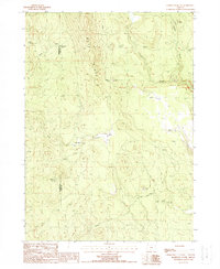
1988 Map of Hamelton Butte
USGS Topo · Published 1988About this map
Booth Ridge dominates the topography of this high-elevation landscape along the border of Klamath and Lake Counties. The presence of Old RR Gr winding through the terrain suggests a history of timber extraction or logistical support for remote outposts, connecting the isolated drainages of Long Creek and Carahan Creek. Remnants of earlier habitation and seasonal use are evident in labels such as Petes Camp (Site), Kings Cabin, and Sams Cabin, which indicate a human presence tied to the land's resources long after the primary industrial activity subsided.
Find a feature on this map
18 named features on this map. Tap any name to fly to it.
Don’t see what you’re looking for? This feature index may not catch every label — zoom into the map to look around manually.
Map Details
Editions of this 1988 Hamelton Butte Map
This is the sole edition of this map. No revisions or reprints were ever made.
Other maps of this area

1889 · Klamath
USGS Topo · 1:250,000

1894 · Klamath
USGS Topo · 1:250,000

1955 · Klamath Falls
USGS Topo · 1:250,000

1958 · Klamath Falls
USGS Topo · 1:250,000

1960 · Riverbed Butte
USGS Topo · 1:62,500

1960 · Sycan Marsh
USGS Topo · 1:62,500

1960 · Fuego Mountain
USGS Topo · 1:62,500

1960 · Yamsay Mountain
USGS Topo · 1:62,500

1980 · Williamson River
USGS Topo · 1:100,000
1988 · Sycan Marsh West
USGS Topo · 1:24,000