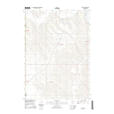
2015 Map of Hamill NE
USGS Topo · Published 2015About this map
The White River winds along the northern reaches of this territory, defining the drainage patterns for a series of creek systems that carve through the landscape. Streams such as Sand Cr and Waver Tree Br flow north toward the river, while the southern portion of the quadrangle is dominated by the headwaters and tributaries of Bull Cr. The terrain is marked by the boundary between Tripp Co and Lyman Co, where a grid of rural roads including 327th Ave and 254th St provides access across the drainage divides. A legacy of the Public Land Survey System is evident in the township and range designations, such as t103n r73w, which organize the homesteaded sections. This 2015 survey reflects a classic Great Plains geography where water sources and section lines dictate the sparse settlement pattern.
Find a feature on this map
17 named features on this map. Tap any name to fly to it.
Don’t see what you’re looking for? This feature index may not catch every label — zoom into the map to look around manually.
Map Details
Editions of this 2015 Hamill NE Map
This is the sole edition of this map. No revisions or reprints were ever made.
Other maps of this area

1935 · Chamberlain
USGS Topo · 1:62,500

1939 · Chamberlain
USGS Topo · 1:62,500

1940 · Iona
USGS Topo · 1:62,500

1944 · Iona
USGS Topo · 1:62,500

1952 · Reliance SW
USGS Topo · 1:24,000

1952 · Reliance SE
USGS Topo · 1:24,000

1952 · Hamill NW
USGS Topo · 1:24,000

1952 · Hamill NE
USGS Topo · 1:24,000

1952 · Oacoma
USGS Topo · 1:24,000

1952 · Iona NW
USGS Topo · 1:24,000