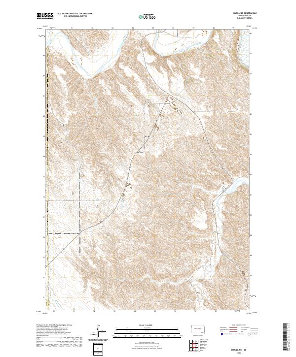
2021 Map of Hamill NE
USGS Topo · Published 2021About this map
The White River winds through the northern reaches of this landscape on the border of Lyman and Tripp counties, carving deep drainages into the high plains of South Dakota. The terrain is defined by a dense network of intermittent stream beds and ephemeral watercourses, including Sand Cr and the uniquely named Waver Tree Br. This 2021 topographic study illustrates the sparse, grid-based infrastructure typical of the rural Midwest, where section lines like 254th Ave and 257th St dictate movement across the plains. Large-scale hydrological features such as Bull Cr and Black Dog Cr provide the primary landmarks in an area dominated by open range and significant elevation changes near the river breaks. The map captures the enduring character of this agricultural and grazing region, showing how few physical structures or permanent settlements break the vast expanse of the northern prairie.
Find a feature on this map
15 named features on this map. Tap any name to fly to it.
Don’t see what you’re looking for? This feature index may not catch every label — zoom into the map to look around manually.
Map Details
Editions of this 2021 Hamill NE Map
This is the sole edition of this map. No revisions or reprints were ever made.
Other maps of this area

1935 · Chamberlain
USGS Topo · 1:62,500

1939 · Chamberlain
USGS Topo · 1:62,500

1940 · Iona
USGS Topo · 1:62,500

1944 · Iona
USGS Topo · 1:62,500

1952 · Reliance SW
USGS Topo · 1:24,000

1952 · Reliance SE
USGS Topo · 1:24,000

1952 · Hamill NW
USGS Topo · 1:24,000

1952 · Hamill NE
USGS Topo · 1:24,000

1952 · Oacoma
USGS Topo · 1:24,000

1952 · Iona NW
USGS Topo · 1:24,000