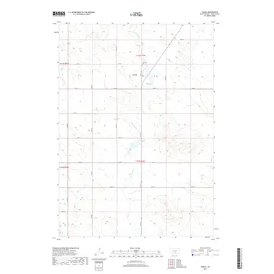
2017 Map of Hamill
USGS Topo · Published 2017About this map
Hamill serves as the central hub of this Tripp County landscape, a small prairie settlement defined by its grid of named streets including Plum St and 324th Ave. This late 2010s survey illustrates a region where water management and agriculture are inextricably linked, evidenced by the presence of Hamill Dam Reservoir and Covey Dam. The surrounding terrain is drained by several watercourses, most notably No Moccasin Cr and Black Dog Cr, which weave through the section lines of the Public Land Survey System. Genealogists and local historians can locate Roseland Cem just northeast of the town center, a key landmark for tracing family roots in this rural South Dakota community. The map provides a precise look at the township and range boundaries that have organized this land since the initial homesteading era.
Find a feature on this map
25 named features on this map. Tap any name to fly to it.
Don’t see what you’re looking for? This feature index may not catch every label — zoom into the map to look around manually.
Map Details
Editions of this 2017 Hamill Map
This is the sole edition of this map. No revisions or reprints were ever made.
Other maps of this area

1951 · Ideal NE
USGS Topo · 1:24,000

1952 · Hamill NW
USGS Topo · 1:24,000

1952 · Hamill NE
USGS Topo · 1:24,000

1955 · Mitchell
USGS Topo · 1:250,000

1959 · Mitchell
USGS Topo · 1:250,000

1971 · Hamill SE
USGS Topo · 1:24,000

1971 · Rattlesnake Butte East
USGS Topo · 1:24,000

1971 · Hamill
USGS Topo · 1:24,000

1971 · Rattlesnake Butte West
USGS Topo · 1:24,000

1982 · King Dam
USGS Topo · 1:25,000