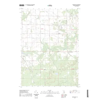
2023 Map of Hamilton East
USGS Topo · Published 2023About this map
The Rabbit River winds through the heart of this Allegan County landscape, defining a rural topography where agricultural land meets wooded creek bottoms. Small community centers like Bentheim and Diamond Springs anchor the grid of section-line roads, serving as focal points for local history and genealogy. Researchers can locate specific burial sites at the Bentheim Cem and Diamond Springs Cem, which are situated near their respective namesake settlements. The terrain is marked by distinctive natural features such as Beaver Meadow and Beach Hill, illustrating the varied glacial geography of Western Michigan. To the southwest, the village of Hamilton sits near the junction of Lincoln Rd and Scenic Dr, while numerous tributaries like Black Creek and Miller Creek drain the surrounding fields and pastures.
Find a feature on this map
55 named features on this map. Tap any name to fly to it.
Don’t see what you’re looking for? This feature index may not catch every label — zoom into the map to look around manually.
Map Details
Editions of this 2023 Hamilton East Map
This is the sole edition of this map. No revisions or reprints were ever made.
Other maps of this area

1928 · Fennville
USGS Topo · 1:62,500

1929 · Holland
USGS Topo · 1:62,500

1931 · Fennville
USGS Topo · 1:62,500

1932 · Holland
USGS Topo · 1:62,500

1958 · Allegan
USGS Topo · 1:62,500

1958 · Grandville
USGS Topo · 1:62,500

1958 · Racine
USGS Topo · 1:250,000

1958 · Grand Rapids
USGS Topo · 1:250,000

1961 · Grand Rapids
USGS Topo · 1:250,000

1962 · Grand Rapids
USGS Topo · 1:250,000