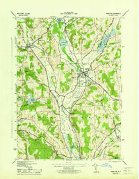
1944 Map of Hamilton
USGS Topo · Published 1944About this map
Colgate University anchors the landscape of central New York during the mid-1940s, situated just east of the village of Hamilton. The region’s reliance on rail transport is evident through the convergence of the New York Ontario and Western Railroad and the Delaware Lackawanna and Western Railroad, which served the local agricultural and academic communities. An abandoned stretch of the New York Ontario and Western Canal Branch follows the Chenango River valley, marking the transition from water-based commerce to industrial rail lines.
Find a feature on this map
49 named features on this map. Tap any name to fly to it.
Don’t see what you’re looking for? This feature index may not catch every label — zoom into the map to look around manually.
Map Details
Editions of this 1944 Hamilton Map
This is the sole edition of this map. No revisions or reprints were ever made.
Other maps of this area

1902 · Morrisville
USGS Topo · 1:62,500

1903 · Norwich
USGS Topo · 1:62,500

1907 · Sangerfield
USGS Topo · 1:62,500

1910 · New Berlin
USGS Topo · 1:62,500

1912 · New Berlin
USGS Topo · 1:62,500

1943 · Otselic
USGS Topo · 1:24,000

1943 · West Eaton
USGS Topo · 1:24,000

1943 · Morrisville
USGS Topo · 1:24,000

1943 · Hubbardsville
USGS Topo · 1:24,000

1943 · Sangerfield
USGS Topo · 1:62,500