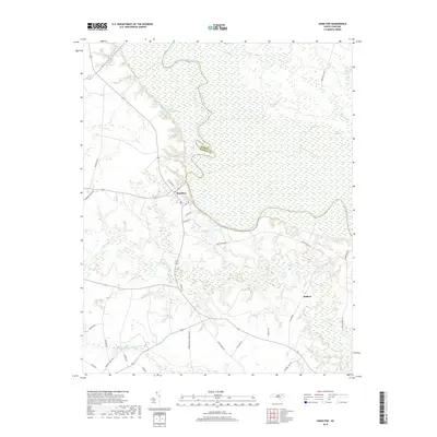
2019 Map of Hamilton
USGS Topo · Published 2019About this map
The Roanoke River carves a deep, winding path through this landscape, serving as the natural boundary between Bertie and Martin counties. The town of Hamilton is positioned on the high ground overlooking a sharp river bend, where a traditional grid of streets including N Railroad St and E Main St meets rural connectors like Fort Branch Rd. This 2019 survey illustrates the dense hydrological network of the Inner Banks, where the primary river is fed by numerous tributaries such as Indian Cr and Conoho Cr. Large wetland areas like Broadneck Swamp and Huskaw Swamp dominate the low-lying terrain, interspersed with agricultural clearings and small settlements like Ballard. Private landmarks, including the Roy Everett Hunting Club Pond, underscore the region's long-standing connection to the land and water.
Find a feature on this map
36 named features on this map. Tap any name to fly to it.
Don’t see what you’re looking for? This feature index may not catch every label — zoom into the map to look around manually.
Map Details
Editions of this 2019 Hamilton Map
This is the sole edition of this map. No revisions or reprints were ever made.
Other maps of this area

1901 · Parmele
USGS Topo · 1:62,500

1901 · Williamston
USGS Topo · 1:62,500

1902 · Williamston
USGS Topo · 1:62,500

1902 · Parmele
USGS Topo · 1:62,500

1953 · Norfolk
USGS Topo · 1:250,000

1953 · Rocky Mount
USGS Topo · 1:250,000

1954 · Rocky Mount
USGS Topo · 1:250,000

1962 · Palmyra
USGS Topo · 1:24,000

1972 · Republican
USGS Topo · 1:24,000

1972 · Woodville
USGS Topo · 1:24,000