
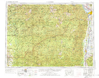
1956 Map of Hamilton
USGS Topo · Published 1970About this map
The Bitterroot River valley serves as the primary corridor for settlement and industry on this mid-century survey, flanked by the massive elevations of the Bitterroot Mountains and Clearwater Mountains. In the north, the city of Missoula stands as a transportation hub where the Northern Pacific and Chicago Milwaukee St Paul and Pacific railroads converge. The valley floor is dotted with established towns including Stevensville, Victor, and Hamilton, supporting a landscape that balances agriculture with proximity to vast protected lands like the Selway Bitterroot Wilderness Area. Historical landmarks such as Fort Missoula and the Fish Hatchery near Corvallis highlight the administrative and resource-management character of the region. This 1956 data, revised in the late 1960s, captures the peak of the mountain-and-valley economy before modern expansion, preserving the locations of smaller settlements like Woodside and Darby along the river's path.
Find a feature on this map
135 named features on this map. Tap any name to fly to it.
Don’t see what you’re looking for? This feature index may not catch every label — zoom into the map to look around manually.
Map Details
Editions of this 1956 Hamilton Map
2 editions found
Other maps of this area

1901 · Hamilton
USGS Topo · 1:125,000

1903 · Bonner
USGS Topo · 1:125,000

1909 · Sapphire
USGS Topo · 1:125,000

1911 · Lolo
USGS Topo · 1:250,000

1912 · Missoula
USGS Topo · 1:125,000

1913 · Lolo
USGS Topo · 1:250,000

1914 · Avery
USGS Topo · 1:125,000

1917 · Avery
USGS Topo · 1:125,000

1918 · St Regis
USGS Topo · 1:125,000

1919 · St. Regis
USGS Topo · 1:125,000