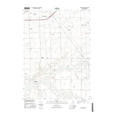
2017 Map of Hamilton West
USGS Topo · Published 2017About this map
The Kalamazoo River and its complex wetlands define the southern landscape of this area, where the river meets the Big Dailey Bayou and the expansive Ottawa Marsh. This 2017 survey reveals the transition from the southern marshlands and Pine Plains to the agricultural and residential corridors surrounding Holland. A significant network of drainage systems, including Jaarda Drain and Kleinheksel Drain, underscores the region's managed hydrology. The settlement pattern is anchored by small communities such as Hamilton and East Saugatuck, which are connected by a grid of rural roads and historical landmarks like the West Michigan Regional Airport. Genealogists will find a high concentration of burial sites, including the distinction between Old Overisel Cem and New Overisel Cem, as well as the Manlius Cem tucked near Mann Cr.
Find a feature on this map
81 named features on this map. Tap any name to fly to it.
Don’t see what you’re looking for? This feature index may not catch every label — zoom into the map to look around manually.
Map Details
Editions of this 2017 Hamilton West Map
This is the sole edition of this map. No revisions or reprints were ever made.
Other maps of this area

1928 · Fennville
USGS Topo · 1:62,500

1929 · Holland
USGS Topo · 1:62,500

1931 · Fennville
USGS Topo · 1:62,500

1932 · Holland
USGS Topo · 1:62,500

1958 · Allegan
USGS Topo · 1:62,500

1958 · Grandville
USGS Topo · 1:62,500

1958 · Racine
USGS Topo · 1:250,000

1958 · Grand Rapids
USGS Topo · 1:250,000

1961 · Grand Rapids
USGS Topo · 1:250,000

1962 · Grand Rapids
USGS Topo · 1:250,000