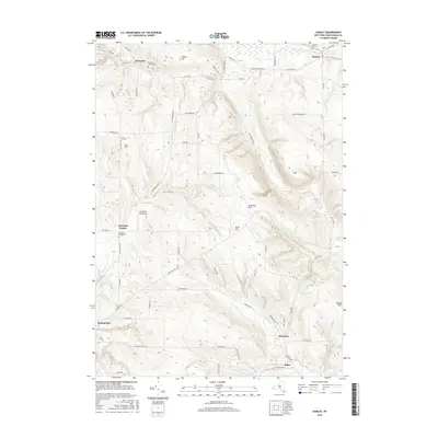
2016 Map of Hamlet
USGS Topo · Published 2016About this map
Charlotte Center and the surrounding high country of Chautauqua County are defined by a series of prominent peaks and deep creek valleys. This 2016 survey illustrates a landscape of elevated ridges including Boutwell Hill, Arab Hill, and Luce Hill, which dictate the winding paths of rural routes like Co Touring Rte 77. The settlement pattern is largely concentrated around historic crossroads and cemetery sites, such as the Burnham Hollow Cem and Charlotte Center Cem, providing valuable touchstones for local genealogy. Waterways such as Canadaway Cr and Clear Cr carve through the terrain, while the presence of Spaulding Aerodrome south of Griswold marks a modern utility in this traditional upland setting. The map captures the quiet transition between the village of Sinclairville and the high, wooded hills to the northeast.
Find a feature on this map
69 named features on this map. Tap any name to fly to it.
Don’t see what you’re looking for? This feature index may not catch every label — zoom into the map to look around manually.
Map Details
Editions of this 2016 Hamlet Map
This is the sole edition of this map. No revisions or reprints were ever made.
Other maps of this area

1900 · Dunkirk
USGS Topo · 1:62,500

1900 · Cherry Creek
USGS Topo · 1:62,500

1904 · Chautaqua
USGS Topo · 1:62,500

1905 · Jamestown
USGS Topo · 1:62,500

1941 · Cherry Creek
USGS Topo · 1:62,500

1941 · Chautauqua
USGS Topo · 1:62,500

1942 · Jamestown
USGS Topo · 1:62,500

1943 · Dunkirk
USGS Topo · 1:62,500
1954 · Kennedy
USGS Topo · 1:24,000

1954 · Ellery Center
USGS Topo · 1:24,000