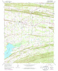
1961 Map of Hamlet
USGS Topo · Published 1986About this map
Cadron Ridge stretches across the northern portion of this landscape, creating a natural boundary between the drainages of Pickle Gap Creek and the meandering Palarm Creek. This 1960s survey illustrates a region defined by small rural hubs and a significant network of country churches, including Old Liberty Ch, New Liberty Ch, and Friendship Ch. The presence of Liberty Sch and numerous named gaps like Roden Mill Gap and Berry Gap suggests a community structure built around established topographic crossings. To the southwest, the waters of Lake Conway begin to dominate the terrain, where Mt Tabor Ch overlooks the spillway. Notable infrastructure like the Pipeline cutting through the center of the sheet and various Quarries near Beryl reflect the local economy's balance between resource extraction and the established agricultural settlements of Hamlet and Saltillo.
Find a feature on this map
30 named features on this map. Tap any name to fly to it.
Don’t see what you’re looking for? This feature index may not catch every label — zoom into the map to look around manually.
Map Details
Editions of this 1961 Hamlet Map
3 editions found
Other maps of this area

1891 · Little Rock
USGS Topo · 1:125,000

1893 · Little Rock
USGS Topo · 1:125,000

1941 · Olmstead
USGS Topo · 1:31,680

1953 · Cato
USGS Topo · 1:24,000

1953 · Mayflower
USGS Topo · 1:24,000

1954 · Olmstead
USGS Topo · 1:24,000

1955 · Little Rock
USGS Topo · 1:250,000

1956 · Little Rock
USGS Topo · 1:250,000

1956 · Russellville
USGS Topo · 1:250,000

1960 · Little Rock
USGS Topo · 1:250,000