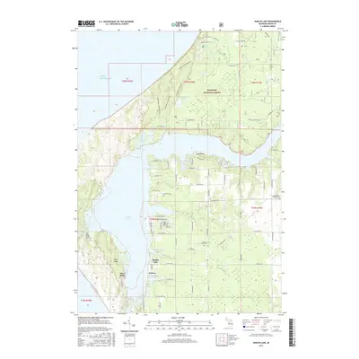
2017 Map of Hamlin Lake
USGS Topo · Published 2017About this map
Hamlin Lake dominates this coastal landscape, its complex shoreline defined by the The Narrows, Middle Bayou, and Indian Pete Bayou. To the north, the protected dunes of the Manistee National Forest preserve a wilder stretch of the Lake Michigan coast, including the secluded Nordhouse Lake. The settlement patterns here reflect a mix of recreation and long-standing local community, with the small residential area of Weimer tucked along the southern shore and several local burial grounds, including the Hamlin Village Cem and Sacred Heart Catholic Cem, marking the history of the surrounding township. This 2017 survey shows a network of forest trails and local roads like W Nurnberg Rd and Porter Creek Rd that provide access to the ridge-and-hollow terrain of Piney Ridge and the dune formations that define the region's northern reaches.
Find a feature on this map
73 named features on this map. Tap any name to fly to it.
Don’t see what you’re looking for? This feature index may not catch every label — zoom into the map to look around manually.
Map Details
Editions of this 2017 Hamlin Lake Map
This is the sole edition of this map. No revisions or reprints were ever made.
Other maps of this area

1931 · Manistee SE
USGS Topo · 1:31,680

1931 · Manistee SW
USGS Topo · 1:31,680

1932 · Ludington NE
USGS Topo · 1:31,680

1932 · Ludington
USGS Topo · 1:31,680

1954 · Milwaukee
USGS Topo · 1:250,000

1954 · Manitowoc
USGS Topo · 1:250,000

1958 · Manitowoc
USGS Topo · 1:250,000

1958 · Milwaukee
USGS Topo · 1:250,000

1958 · Manistee
USGS Topo · 1:62,500

1959 · Ludington
USGS Topo · 1:62,500