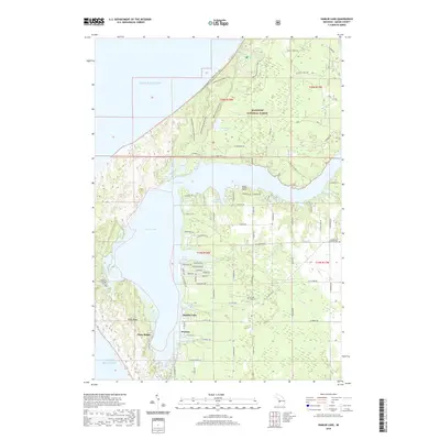
2019 Map of Hamlin Lake
USGS Topo · Published 2019About this map
Hamlin Lake and the eastern shore of Lake Michigan define this coastal landscape in the Manistee National Forest. The map documents a complex system of waterways, including The Narrows, Indian Pete Bayou, and North Bayou, which segment the terrain into distinct peninsulas like Bugg Point. Residential development is concentrated around small clusters such as Hamlin Village and Weimer, with a network of local roads like W Fountain Rd and W Dewey Rd connecting the various bayous and shorelines.
Find a feature on this map
67 named features on this map. Tap any name to fly to it.
Don’t see what you’re looking for? This feature index may not catch every label — zoom into the map to look around manually.
Map Details
Editions of this 2019 Hamlin Lake Map
This is the sole edition of this map. No revisions or reprints were ever made.
Other maps of this area

1931 · Manistee SE
USGS Topo · 1:31,680

1931 · Manistee SW
USGS Topo · 1:31,680

1932 · Ludington NE
USGS Topo · 1:31,680

1932 · Ludington
USGS Topo · 1:31,680

1954 · Milwaukee
USGS Topo · 1:250,000

1954 · Manitowoc
USGS Topo · 1:250,000

1958 · Manitowoc
USGS Topo · 1:250,000

1958 · Milwaukee
USGS Topo · 1:250,000

1958 · Manistee
USGS Topo · 1:62,500

1959 · Ludington
USGS Topo · 1:62,500