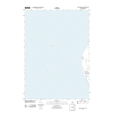
2011 Map of Hamlin Lake OE W
USGS Topo · Published 2011About this map
Big Sable Point projects into the expansive waters of Lake Michigan on this survey from 2011. The landscape is defined by the coastal transition where the Big Sable River meets the shoreline, creating a unique environment preserved within the state park system. Navigation and public recreation dominate the land use, centered on the landmark Big Sable Light. The interior terrain is navigated via a series of paths, including Lighthouse Trl, Beechwood Trl, and Logging Trl, which connect the shore to inland campgrounds. The map documents the layout of the Ludington State Park Cedars Campground and the Ludington State Park Pines Campground, illustrating the infrastructure for modern outdoor recreation along this prominent Michigan peninsula.
Find a feature on this map
9 named features on this map. Tap any name to fly to it.
Don’t see what you’re looking for? This feature index may not catch every label — zoom into the map to look around manually.
Map Details
Editions of this 2011 Hamlin Lake OE W Map
This is the sole edition of this map. No revisions or reprints were ever made.
Other maps of this area

1931 · Manistee SW
USGS Topo · 1:31,680

1932 · Ludington
USGS Topo · 1:31,680

1954 · Milwaukee
USGS Topo · 1:250,000

1954 · Manitowoc
USGS Topo · 1:250,000

1958 · Manitowoc
USGS Topo · 1:250,000

1958 · Milwaukee
USGS Topo · 1:250,000

1958 · Manistee
USGS Topo · 1:62,500

1959 · Ludington
USGS Topo · 1:62,500
1982 · Hamlin Lake
USGS Topo · 1:25,000
1982 · Manistee NW
USGS Topo · 1:25,000