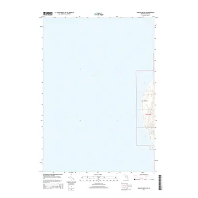
2014 Map of Hamlin Lake OE W
USGS Topo · Published 2014About this map
Big Sable Point stands as the primary landmark on this coastal survey, where the Michigan shoreline meets the expansive waters of Lake Michigan. The map focuses on the thin strip of land where the Big Sable River flows toward the lake, highlighting a transition between the aquatic environment and the terrestrial features of t19n r18w. The primary transportation route, M-116, follows the curvature of the coast, providing access to this specific stretch of the Lake Michigan shoreline. This 2014 data captures the precise elevation and hydrography of the point before further natural shoreline shifts, making it a valuable reference for environmental changes and coastal management in the region.
Find a feature on this map
10 named features on this map. Tap any name to fly to it.
Don’t see what you’re looking for? This feature index may not catch every label — zoom into the map to look around manually.
Map Details
Editions of this 2014 Hamlin Lake OE W Map
This is the sole edition of this map. No revisions or reprints were ever made.
Other maps of this area

1931 · Manistee SW
USGS Topo · 1:31,680

1932 · Ludington
USGS Topo · 1:31,680

1954 · Milwaukee
USGS Topo · 1:250,000

1954 · Manitowoc
USGS Topo · 1:250,000

1958 · Manitowoc
USGS Topo · 1:250,000

1958 · Milwaukee
USGS Topo · 1:250,000

1958 · Manistee
USGS Topo · 1:62,500

1959 · Ludington
USGS Topo · 1:62,500
1982 · Hamlin Lake
USGS Topo · 1:25,000
1982 · Manistee NW
USGS Topo · 1:25,000