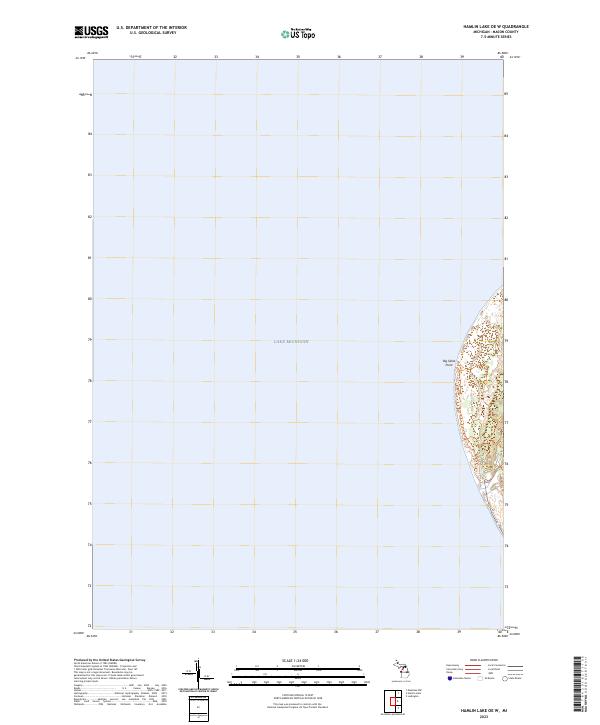
2023 Map of Hamlin Lake OE W
USGS Topo · Published 2023About this map
Lake Michigan dominates this coastal survey, where the expanse of the Great Lakes meets the western edge of Michigan. The primary land feature is Big Sable Point, a distinctive projection into the lake characterized by a complex network of coastal contours and dunes. This portion of the shore is situated within township t19n r18w, capturing the interface between deep water and the shifting sandy terrain of the shoreline. The mapping reflects a landscape defined by natural coastal processes, showing the precise topography of the point and its immediate vicinity as it appeared in the early 21st century.
Find a feature on this map
7 named features on this map. Tap any name to fly to it.
Don’t see what you’re looking for? This feature index may not catch every label — zoom into the map to look around manually.
Map Details
Editions of this 2023 Hamlin Lake OE W Map
This is the sole edition of this map. No revisions or reprints were ever made.
Other maps of this area

1931 · Manistee SW
USGS Topo · 1:31,680

1932 · Ludington
USGS Topo · 1:31,680

1954 · Milwaukee
USGS Topo · 1:250,000

1954 · Manitowoc
USGS Topo · 1:250,000

1958 · Manitowoc
USGS Topo · 1:250,000

1958 · Milwaukee
USGS Topo · 1:250,000

1958 · Manistee
USGS Topo · 1:62,500

1959 · Ludington
USGS Topo · 1:62,500
1982 · Hamlin Lake
USGS Topo · 1:25,000
1982 · Manistee NW
USGS Topo · 1:25,000